At the Dickson Dam control room there are graphs showing the typical rise and fall of water flows as the snows melt in the plains and mountains, and the spring and early summer rains come.
This year’s line has veered off the usual pattern. Water flows are about half what they are usually at this time of year.
It’s yet another sign — and for many, a depressing one — that spring is taking its sweet time doing its thing.
“This year, our summer melt is probably two weeks behind your average year,” said Ross Martyn, Dickson Dam team leader.
“Now, it’s kind of a waiting game to see what happens; whether the rains come first or the summer melt comes first.
“Either way, it’s all good water for us.”
The plains snow has already melted, but the stuff higher up in the mountains is stubbornly hanging on this year.
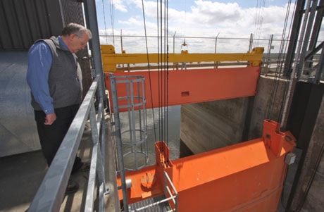
Martyn can monitor these “snow pillows” via a pair of instrumentation sites — at Skoki Lodge and Limestone Ridge in the mountain areas north and east of Banff.
“We’ve got almost real-time snowfall information.”
This weekend’s long-awaited warm spell is expected to send some snow melt down the Red Deer River and all its tributaries.
Martyn said campers, fishers and other river users should be careful because there is no way to predict exactly when the inflows will increase to the 54 cubic metres per second that is typical for this year. During the week, flows were barely above the 16 cubic metres per second rate that is the minimum flow maintained by the dam.
Martyn advises people to keep off mid-river sandbars and said over the years a few people have learned a soggy lesson in the perils of camping too close to the river.
Construction on the dam and reservoir, known as Gleniffer Lake, started in 1980 and it was filled for the first time in 1984. It was built for a number of reasons, the most important one was to ensure a dependable supply of water downstream to support communities and industry.
Before the dam was built, winter could limit water flows to a trickle of as little as two cubic metres per second.
The reservoir was also designed to improve fish habitats, provide recreation, and improve downstream water quality. The dam and reservoir also offer a limited amount of flood control, he said.
To do all that, 3.6 million cubic metres of fill was piled up 40 metres high across the mouth of the river. The 650-metre long dam sits on bedrock and includes a central clay core with a Plasticene-like consistency that is impermeable to water. Outside the core, rock layers hold it in place and also serve to drain away any water that seeps into the massive structure harmlessly into the ground and away from the site.
“The strength of the dam is really in the mass of it,” he said. Operators continually monitor the dam and check for any seepage and a system of alarms is in place to warn of any problems.
“There are over 100 pieces of instrumentation checking the safety of the dam at any one time.”
If an alarm goes off, it is immediately patched through to an operator. If they are away from the site they are reached by cellphone and the dam can be monitored over the Internet.
The 60-metre-wide spillway and its five, 32-tonne gates are the most prominent feature of the dam. But at this time of year they remain closed.
Water passing through the dam is directed down one of two, 525-metre-long tunnels that can handle a combined 100 cubic metres of water per second. One of the tunnels feeds an Algonquin Power generating station, which has three five-megawatt power generators connected through the Innisfail substation to the Alberta power grid.
The power plant always gets the first water of the day, since there is no sense in wasting water that can be used to generate electricity for Albertans.
While flood control is not its primary purpose, the dam proved its worth during the June 2005 flood that swelled the Red Deer River several metres, flooding Bower Ponds, the Lions campground and other low-lying areas.
Enough water passed through the Dickson Dam reservoir in the days around the record-setting 2005 flood to fill the 11-km long man-made lake more than four times over.
Consider that the reservoir holds 203 million cubic metres of water — or 203 billion litres — and one gets a sense of the potential for disaster that was avoided through a combination of good planning and cool heads.
Martyn was called at home and warned by Alberta Environment’s River Forecasting Centre that there was potential trouble brewing. A large cold low weather system was headed for Alberta carrying a lot of moisture.
Martyn and other dam staff immediately went to work preparing for the coming deluge. Water was released from the dam for more than a day before the rain hit Central Alberta.
Despite the massive flow of water, which led hundreds of awed spectators to gather along riverbanks, the reservoir never filled beyond its designated full point. In fact, the main spillway was only releasing a little over half as much water as it could. “It had quite a bit of capacity for even that storm.”
At the peak of the flood on the Father’s Day weekend, 1,652 cubic metres per second were passing through the five gates, which can handle about 2,700 cubic metres per second. A pair of emergency spillways, designed with plugs that collapse when water overflows them, boost that capacity to about 5,300 cubic metres per second.
There are already plans in place to nearly double that capacity.
“When the dam was built, 5,200 was considered the probably maximum flood.
“Since then there have been some storms in Alberta that have made dam engineers recalculate what that maximum flood might be.”
At Dickson, another emergency spillway will be built and the main spillways will be upgraded, likely in the next few years.
Martyn said the increases reflect changes in the way floods are calculated and new information about nature’s potential.
“Being a young province and a young country there’s not hundreds of hundreds of years of records like Europe or somewhere like that.”