Central Albertans got another reminder this week that the only consistent thing about our weather is its inconsistency.
Take the temperature, for example. At 6 p.m. on Monday it was 1 C. Two hours later, the temperature had dropped 12 degrees.
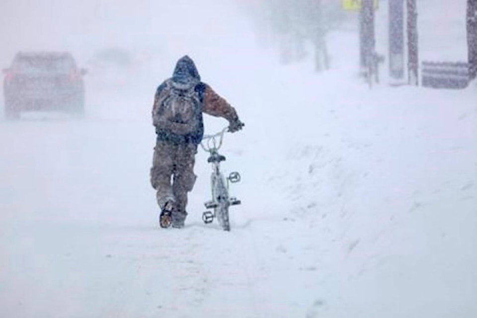
Then, the wind picked up and the snow started falling, prompting Environment Canada to issue relatively rare snow squall warnings and alerts for areas from Red Deer to Calgary. Winter storm warnings were also issued for a huge swath of the province from north of Edmonton to Lloydminster. In east Central Alberta, there were wind warnings and in northern Alberta extreme cold warnings.
“Basically, a snow squall is just a really heavy band of snow,” said Environment Canada meteorologist Kyle Fougere on Tuesday.
“They typically happen near open waters. It’s something we see near the Great Lakes, or Great Slave Lake in the Northwest Territories. When you have an open body of water where it’s not ice covered and there’s cold air going over it you often get these strong bands of snow.
“But in Alberta what we do see sometimes are frontal snow squalls. What typically happens is what happened (Monday). You have a strong cold front, a very active cold front move, through the province … and you have a really strong band of snow on it with a strong wind associated.
“You can have a really big change in the weather over a short period of time. That’s why we have that warning to give people the heads up that the weather can change very quickly along this cold front.”
The band of snow ran east to west and it was pushed down through central Alberta by the fast-moving cold front from the north, which had winds of 50 km/h, gusting to 75 km/h. The driving snow reduced visibility to 400 metres in the Red Deer area as the cold front passed through.
For drivers, that combination meant near-whiteout conditions at times and led to mayhem on Highway 2. By early evening, RCMP were warning motorists to stay off the highway and shortly after 7 p.m. Alberta Emergency alert issued a dangerous highway condition alert for a large stretch of Highway 2, including central Alberta. It was lifted shortly before 7 a.m. on Tuesday.
Around 9 p.m., Highway 2 between Bowden and Crossfield was fully closed because of multiple collisions. It did not fully reopen until 5 a.m. Numerous crashes were also reported between Penhold and Innisfail.
The system headed southeasterly overnight and was heading into the U.S. south of Manitoba by Tuesday morning.
Central Albertans will get another taste of weather whiplash in coming days. A low-pressure system is expected to draw cold air down from the north leading to a high of only -18 C on Tuesday and -15 C on Wednesday — well below the average high of -6 C for this time of year.
The low on Tuesday night was expected to sink to -30 C, compared with the average low of -18 C.
Environment Canada issued an extreme cold warning for most of central Alberta on Tuesday afternoon, where wind chill was expected to hit -40 C.
However, the cold snap eases on Thursday when a warmer air mass from the West is expected to push temperatures up to 1 C, followed by -3 C on Friday and a relatively balmy 5 C on Saturday and 7 C on Sunday.
“Through the weekend and into next week we’re going to stay above normal,” he said, adding that we can expect more typical temperatures to return later in the month.