December is supposed to ease us into winter, with an average daily high in Red Deer of -5C and a low of -17.
Instead, winter was smooshed into our frigid faces with an average high of -11 and a low of -23.
If December 2009 seemed like a ridiculously cold and snowy month — it was. According to Environment Canada, the mercury plunged to -30C or colder on seven days — including Dec. 14, which featured a shiver-me-timbers low of -40.5 and a high of only -27.
“That day was definitely record-smashing,” said Environment Canada meteorologist John McIntyre, who noted the previous record low for the date was -34 in 1948.
McIntyre blames our unusually cold December on Arctic air descending on Central Alberta, instead of a more moderating Pacific front.
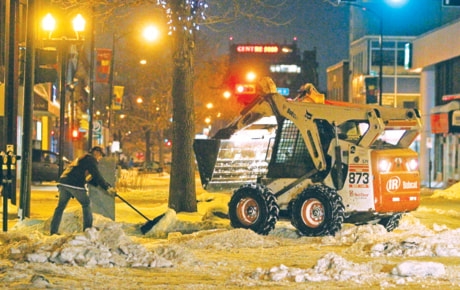
While northern weather systems tend to be drier, that certainly wasn’t the case when a total of 50 cm of snow fell last month, pushing the City of Red Deer’s 2009 snow clearing budget $1 million into the red.
Since Environment Canada doesn’t keep monthly precipitation records, McIntyre can’t tell if previous records were broken, but he said 50 cm is more than double the December average snowfall of 19 cm. And it certainly beats the December snowfall of the last few years — which ranged from a scant 3.8 cm in 2005 to 22.2 cm in 2008.
Brace for some additional snow this week, with one to two cm expected on Monday night and an additional two to three cm forecast for today.
Northern air will keep Central Alberta in its cold embrace until at least mid-week (Wednesday’s forecast high in Red Deer is only -18 and the low is -27).
But McIntyre sees a warming trend coming and even expects some clear skies and sun in the area later this week.
lmichelin@www.reddeeradvocate.com