A winter that didn’t want to leave has been followed by the summer that can’t wait to arrive.
With four weeks of spring left to go, Central Albertans have been basking in a summer-like heat wave all week. The next few days are looking good too.
“It’s more like summer than when summer actually happens some years,” said Environment Canada meteorologist Dan Kulak with a chuckle on Thursday.
“The weather pattern is very much a summer pattern right now. It’s a weather pattern you more often see in July rather than right now.”
The dramatic swing in temperatures after winter finally loosened its grip has been a common topic of conversation wherever you go.
“It’s really weird to think that six weeks ago we were talking about ‘when is this winter finally going to end,’” said Kulak.
The average daytime high this time of year is 19 C. Red Deer and much of the province has been blowing that away all week. On Thursday, the temperature in Red Deer peaked at around 28 C.
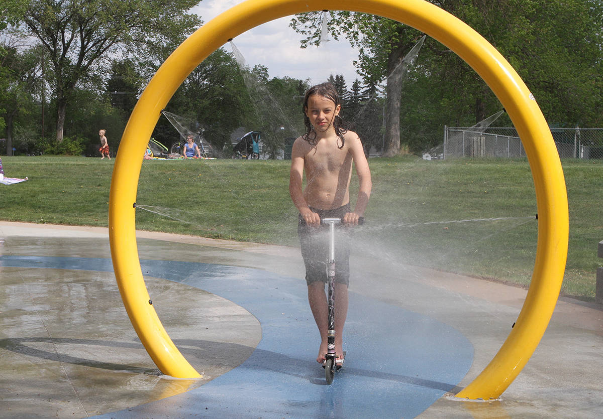
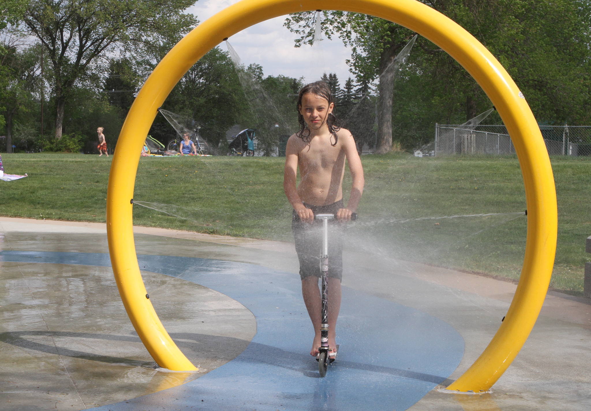
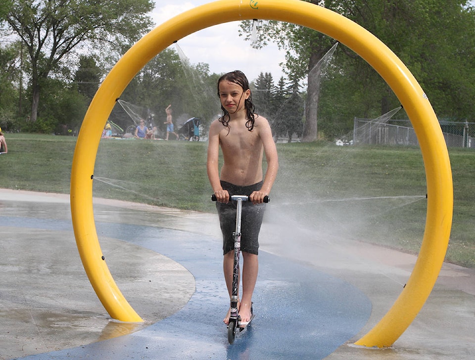
Weather has been so nice the City of Red Deer opened the Blue Grass Sod Farms Central Spray and Play Park earlier than usual.
Water was turned on Thursday at 11 a.m. at the free spray park at 47A Avenue and 48th Street at the northwest corner of Rotary Recreation Park. The park closes at 7 p.m.
Record highs were set in a handful of Alberta communities — Edmonton, Fort Chipewyan, Fort McMurray, High Level, Jasper and Peace River — on Wednesday.
Heat warnings remained in effect on Thursday for the top northern third of the province.
Red Deer topped out at 27.6 C, far short of the record high of 31.7 C in 1941, accord to Environment Canada records going back to 1938. The lowest temperature for May 23 — -6.1 C in 1949.
A lot of what is happening can be put down to the usual vagaries of weather.
“We get into these patterns where year to year it’s going to be a different personality
“If every May 24 was the same year to year you wouldn’t need a meteorologist.
“The fundamental bottom line of why is much different this year than last year, well it’s because things are always different.”
It looks like the weather will stay good for the next few days, with a possibility of showers on Saturday, which is expected to be a little cooler with a high around 22 C.
The heat will be turned up again on Sunday, with a high of 25 C forecast, and Monday, when a real scorcher at 30 C is projected. Temperatures may cool off by the end of next week to within a few degrees of more typical temperatures for this time of year in the low 20 C range.
“In general, above-normal temperatures through that seven-day period.”
pcowley@reddeeradvocate.com
Like us on Facebook and follow us on Twitter