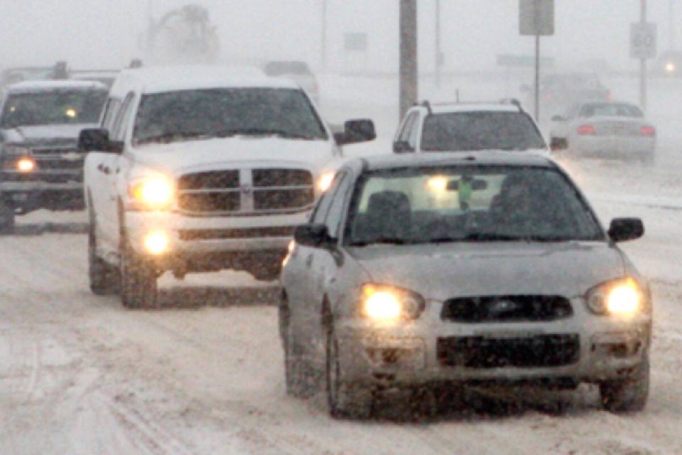
Central Alberta RCMP detachments responded to more than 150 collisions over the weekend, as heavy snowfall caused havoc on roadways.
Police across Alberta responded to 417 collisions from Friday to Sunday – 157 of those collisions were located within central Alberta.
Of the 157 central Alberta collisions, 37 resulted in injuries. Information regarding whether there were any fatalities over the weekend is currently unavailable.
On Saturday afternoon, police issued a press release advising Albertans of “extremely poor” drivings conditions on Highway 2 between Leduc and Airdrie.
There were a number of vehicles in the ditch and multiple collisions on the highway near Ponoka and Olds, according to police. Multi-vehicle collisions by both of those central Alberta towns around 1:30 p.m. caused temporary closures on the highway, said Alberta RCMP Cpl. Troy Savinkoff.
“There were road conditions at that particular time that were especially bad,” Savinkoff told The Advocate on Monday.
“We have to remind drivers that if you have extremely reduced visibility and you’re on icy roads, it’s imperative that your speed is adjusted. If visibility is very small and you don’t think you can stop in time, then that’s a problem. That’s why we get these multi-vehicle collisions.”
Curtis Schaefer, Red Deer Emergency Services assistant deputy chief, said there were multiple minor collisions within city limits over the weekend. EMS crews helped out with collisions on Highway 2, Schaefer added.
Schaefer has advice for drivers when it’s snowing like it was this past weekend: slow down.
“Stay home if you don’t need to. On Saturday, the conditions with the blowing snow made it slippery and the amount of snow made it difficult to drive,” said Schaefer.
“Stay home if you don’t need to go out and venture on the highway. If you do need to, make sure you’re prepared with blankets and water in your vehicle in case you get stranded or stuck in traffic for an extended period of time.”
Natalie Hasell, Environment and Climate Change Canada warning preparedness meteorologist, said the Red Deer area has been dealing with plenty of snow so far this month.
“Red Deer has had some kind of precipitation almost non-stop since the beginning of November,” she said.
Environment Canada’s forecast shows the city will get a break from snowfall starting Tuesday. But temperatures are going to drop notably for a few days, said Hasell.
“We are seeing the advance of a ridge of high pressure at this time defined by Arctic air,” she said.
“Daytime temperatures won’t be very different … but nighttime temperatures (will be low). On Tuesday night we’re expecting -27 C, and the same for Wednesday night.
“Luckily we are under a ridge in this case and the winds aren’t expected to be particularly bad.”
According to the forecast, Tuesday’s daytime high will be -15 C, Wednesday’s will be -17 C and Thursday’s will be -15 C. the temperature will be a little warmer later in the week: Friday’s daytime high is forecasted to be -7 C, while Saturday and Sunday are both expected to be -2 C.
“We see temperatures somewhere between 0 C and -10 C for a good period of time after that. It’s relatively stable looking after this weekend,” said Hasell.
sean.mcintosh@reddeeradvocate.com
Like us on Facebook and follow us on Twitter