Cold, blowy weather with windchills in the double-digits are giving central Albertans a bitter taste of winter.
Winds gusted up to 80 km/h on Tuesday, creating a windchill of -16 C and causing power outages across the province.
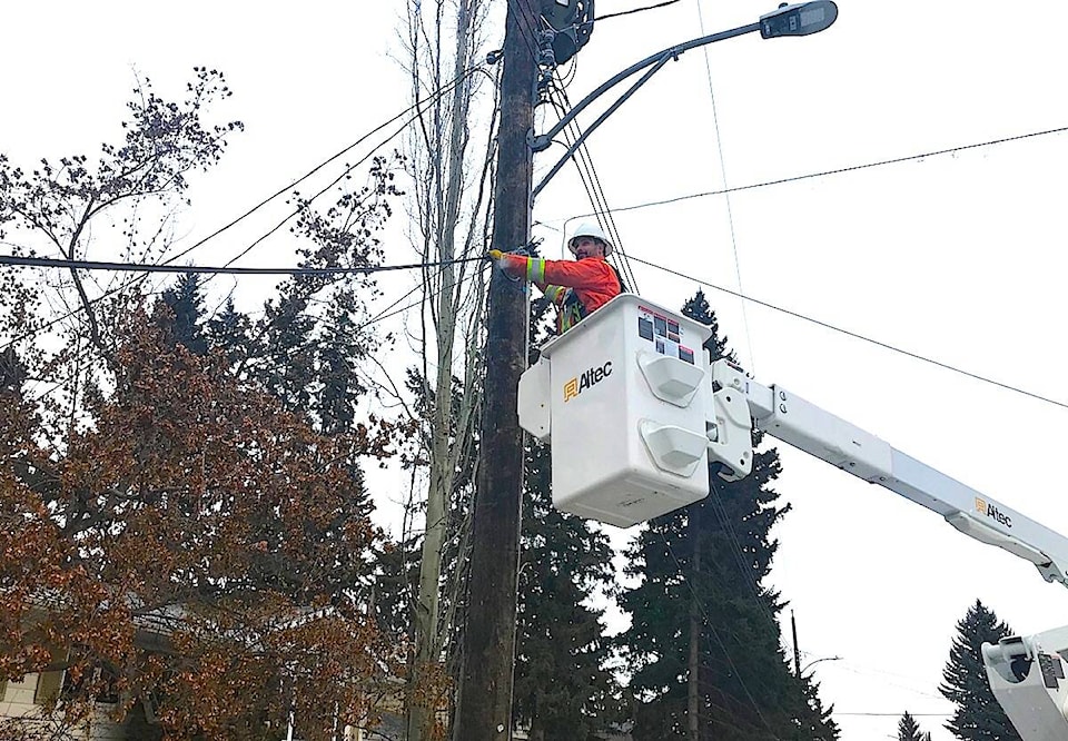
FortisAlberta reported problems in central and southern Alberta because of high winds and blowing snow.
In Red Deer, Electric Light and Power workers were busy reconnecting electricity to 20 homes in the Mountview area after a tree fell across a power line on 43A Avenue. Once the thick tree trunk was removed, power to the street was restored by about 12:30 p.m. on Tuesday.
While the high wind is expected to taper off on Wednesday, windchill in Red Deer is still expected to be -18 in the morning — with an actual mid-week high of -2 on Wednesday and -12 C at night.
“It will be quite the change from what we’ve been seeing,” confirmed Kyle Fougere, a meteorologist with Environment and Climate Change Canada.
Since mid-October, central Alberta has only had one week that was a little below normal, temperature-wise, “the rest of the time we’ve been above-normal. But this is the end of the warm and dry period we’ve had. We’re into more normal weather for November,” added Fougere.
Average temperatures for this time of year are a high of zero degrees and a low of -10 C.
Environment Canada is forecasting more seasonal fall temperatures for the rest of the week, with Saturday’s high is expected to be -7 C, with a mix of sun and cloud and a low of -15 C. The colder weather is expected to last into mid-next week.
While Southern British Columbia has been struggling under huge amounts of rain and floods, central Alberta has actually been much drier than normal.
The same destructive storm system that caused mudslides and evacuations in Merritt B.C. earlier this week passed over the Red Deer area on Monday night and into Tuesday. Fougere said it brought strong winds as well as snow to some regions — Edmonton and northern Alberta saw more snowfall, as did some ski areas, which reported as much as 30 to 40 cm.
But the Red Deer region got just a dusting of the white stuff. Fougere said 15-17 mm of precipitation is normal for November. But, at mid-month, the city is standing at just 1 to 2 mm.
This follows a very dry September and October, which respectively saw only 10 mm and 1 mm, compared to averages of 50.2 mm and 22.3 mm for those months.
The in-coming colder weather system promises to be less stable and unpredictable, however, so central Albertans will likely experience more wet weather in the weeks ahead, said Fougere.
lmichelin@reddeeradvocate.com
Like us on Facebook and follow us on Twitter